Watch the Med
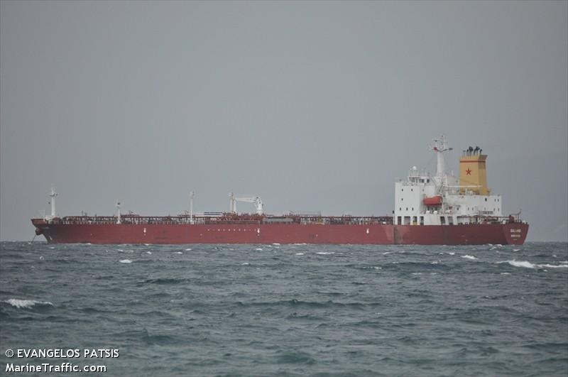
Development WTM siteTanker "Salamis" carrying migrants stopped from entering Malta
05.08.2013 / 11:00 / Malta
In the night of the 4th to the 5th of August 2013, the MV Salamis, a tanker ship flying the Liberian flag but owned and managed by a Greek company, was requested by the Italian Coast Guards to assist 102 migrants in distress located 45 nautical miles off the Libyan coast (within the undeclared Libyan SAR zone), near by the tanker's location as it left the Libyan port of Al Khums heading towards Malta. The tanker was requested by the Italian authorities to disembark the migrants in the port of Al Khums, the vessel’s last port of call and the closest port to the site of the rescue. The Tanker however refused and continued heading towards its planed next port of Valletta. The Maltese Government informed the captain that it would not be allowed to disembark the migrants in Malta. The tanker was stopped by the Armed Forces of Malta (P 52), 24 nautical miles off the island.
On August the 6th 2013, the European Commission(EC)ordered Malta to allow the migrants to disembark in response to the urgent humanitarian needs of the passengers.
Several statements were made by NGOs, including Aditus, JRS, the Migrants’ Network for Equality, SOS Malta, Kopin, Integra Foundation, the Foundation for Shelter and Support to Migrants and the Organisation for Friendship in Diversity, who issued a statement in which they said:
"We remind Italy and Malta that the rescue operation should result in the migrants being disembarked at a safe port. We subscribe to, and strongly urge an interpretation of safe that is not limited to immediate physical safety but which also looks at the human rights situation the rescued persons would be exposed to. Will any rescued asylum-seekers have the opportunity to present their asylum claims in Libya, or will they be forcibly returned to their countries of origin? Will they be locked up in detention centres that violate their human dignity? Will they be exposed to risks of torture, rape, assault and other forms of physical and psychological violence? Will vulnerable individuals be provided with the necessary support?"
On the 7th of August 2013, the Italian authorities finaly accepted to allow the Salamis to disembark the 102 migrants in the port of Syracuse.
The trajectories of the vessels in question is reconstituted based on automated vessel tracking data (AIS) as provided by Marinnetraffic.com
http://www.boats4people.org/index.php/en/news/press-releases/622-are-mediterranean-states-dreaming-of-a-qeuropean-papua-new-guineaq-where-they-can-lock-up-their-boat-people
http://w2eu.net/2013/08/06/solidarity-with-the-crew-of-salamis-who-rescued-102-boatpeople-and-are-blocked-on-open-sea-by-maltese-maritime-forces/
http://aditus.org.mt/aditus_foundation/Home/Entries/2013/8/5_Preservation_of_life_should_be_the_top-most_priority%2C_joint_NGO_statement.html
http://www.maltatoday.com.mt/en/newsdetails/news/national/SLIDESHOW-Salamis-adrift-Malta-refuses-access-to-rescued-asylum-seekers-20130806
On August the 6th 2013, the European Commission(EC)ordered Malta to allow the migrants to disembark in response to the urgent humanitarian needs of the passengers.
Several statements were made by NGOs, including Aditus, JRS, the Migrants’ Network for Equality, SOS Malta, Kopin, Integra Foundation, the Foundation for Shelter and Support to Migrants and the Organisation for Friendship in Diversity, who issued a statement in which they said:
"We remind Italy and Malta that the rescue operation should result in the migrants being disembarked at a safe port. We subscribe to, and strongly urge an interpretation of safe that is not limited to immediate physical safety but which also looks at the human rights situation the rescued persons would be exposed to. Will any rescued asylum-seekers have the opportunity to present their asylum claims in Libya, or will they be forcibly returned to their countries of origin? Will they be locked up in detention centres that violate their human dignity? Will they be exposed to risks of torture, rape, assault and other forms of physical and psychological violence? Will vulnerable individuals be provided with the necessary support?"
On the 7th of August 2013, the Italian authorities finaly accepted to allow the Salamis to disembark the 102 migrants in the port of Syracuse.
The trajectories of the vessels in question is reconstituted based on automated vessel tracking data (AIS) as provided by Marinnetraffic.com
Last update: 14:12 Nov 01, 2013
Sources
http://www.timesofmalta.com/articles/view/20130805/local/tanker-carrying-migrants.480832http://www.boats4people.org/index.php/en/news/press-releases/622-are-mediterranean-states-dreaming-of-a-qeuropean-papua-new-guineaq-where-they-can-lock-up-their-boat-people
http://w2eu.net/2013/08/06/solidarity-with-the-crew-of-salamis-who-rescued-102-boatpeople-and-are-blocked-on-open-sea-by-maltese-maritime-forces/
http://aditus.org.mt/aditus_foundation/Home/Entries/2013/8/5_Preservation_of_life_should_be_the_top-most_priority%2C_joint_NGO_statement.html
http://www.maltatoday.com.mt/en/newsdetails/news/national/SLIDESHOW-Salamis-adrift-Malta-refuses-access-to-rescued-asylum-seekers-20130806
| Credibility: |  |
 |
0 |
Related Reports
21:42 Aug 19, 2021 /
Central Mediterranean Sea Kms
18/08: 8 travellers in distress in Maltese SAR, rescued and brought to Malta.
10:09 Aug 30, 2020 /
Central Mediterranean Kms
29/08: approximately 50 people started in Libya and reached Sicily, Armed Forces of Malta prevented them from entering Maltese territorial waters
10:02 Jun 23, 2019 /
Central Mediterranean Sea Kms
22/06: 40 people coming from Libya in distress, rescued to Malta
16:30 Jul 23, 2021 /
Central Mediterranean Sea Kms
22/07: Around 150 travellers in urgent distress at sea abandoned for many hours, finally intercepted.
21:20 Jun 01, 2024 /
Central Mediterranean Kms