Watch the Med
Development WTM siteThermi Wreck - 21 people found dead, at least 6 missing
14.12.2012 / 11:20 / Thermi - Lesvos Isl. - Greece
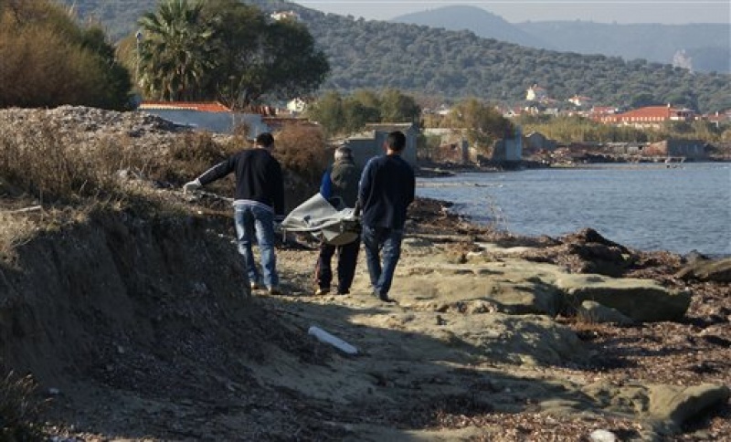
Α tragic ship wreck off the coast of Lesvos island occurred in the early hours of Friday 14 December, when a small boat carrying 28 Afghans, trying to reach the island’s shores, capsized or hit some surfacing rocks (according to some reconstructions of the case, two Turkish persons were also present on the boat, but this information has not been confirmed).
The boat had left the Turkish coast at around 2am in the night.
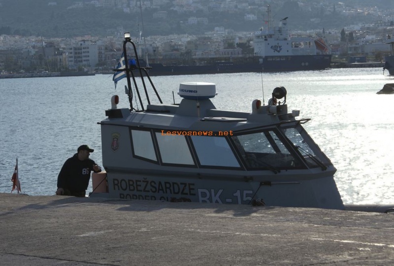
One survivor was found by a boat of the Latvia coast guard operating in the frame of Frontex JO Poseidon and the taken to Lesvos hospital.
According to information of the Greek Coastguard, 21 dead bodies were recovered from the sea or found in the area of Thermi in the following hours.
---
Information concerning this case was gathered during interviews with local researchers during WTM fieldwork in Lesvos in October 2013.
http://lesvos.w2eu.net/2012/12/15/three-dead-migrants-found-on-december-15-at-the-coast-of-lesvos-one-survivor-20-still-missing/
http://tvxs.gr/news/ellada/nayagio-me-15-nekroys-metanastes-stis-aktes-tis-lesboy
http://uk.reuters.com/article/2012/12/15/uk-greece-boat-idUKBRE8BE05B20121215
http://www.aljazeera.com/news/europe/2012/12/20121215113355595623.html
The boat had left the Turkish coast at around 2am in the night.
One survivor was found by a boat of the Latvia coast guard operating in the frame of Frontex JO Poseidon and the taken to Lesvos hospital.
According to information of the Greek Coastguard, 21 dead bodies were recovered from the sea or found in the area of Thermi in the following hours.
---
Information concerning this case was gathered during interviews with local researchers during WTM fieldwork in Lesvos in October 2013.
Last update: 16:58 Dec 05, 2013
Sources
http://www.unric.org/en/latest-un-buzz/28110-tragedy-in-lesvos-21-dead-at-sea-and-6-missing-in-attempt-to-cross-from-turkish-coasthttp://lesvos.w2eu.net/2012/12/15/three-dead-migrants-found-on-december-15-at-the-coast-of-lesvos-one-survivor-20-still-missing/
http://tvxs.gr/news/ellada/nayagio-me-15-nekroys-metanastes-stis-aktes-tis-lesboy
http://uk.reuters.com/article/2012/12/15/uk-greece-boat-idUKBRE8BE05B20121215
http://www.aljazeera.com/news/europe/2012/12/20121215113355595623.html
| Credibility: |  |
 |
0 |
Related Reports
18:27 Jun 16, 2020 /
Aegean Sea Kms
15/06 45 stranded on Lesvos feared pushback, but were eventually taken into quarantine
10:00 Sep 10, 2017 /
Aegean Sea Kms